42450 postal code
MexicoUpdated 2026-11-09El Charcón, HidalgoTecozautla5 digits
Postal code details
12 placesCode
42450
Place
El Charcón
Region
Hidalgo
County
Tecozautla
Coordinates
20.5182, -99.7318
Accuracy
3 / 6
Country
Mexico
Location
OpenStreetMap ↗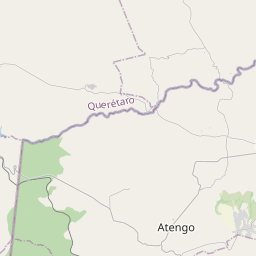
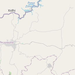


20.5182, -99.7318© OpenStreetMap
Ad slot · 300×250
Places under this code
12| Place | Region | County | Coordinates |
|---|---|---|---|
| El Charcón | Hidalgo | Tecozautla | 20.5182, -99.7318 |
| El Mercader | Hidalgo | Tecozautla | 20.5203, -99.8089 |
| Gandho | Hidalgo | Tecozautla | 20.5453, -99.6874 |
| La Alameda | Hidalgo | Tecozautla | 20.4863, -99.7374 |
| La Cruz de Piedra | Hidalgo | Tecozautla | 20.5486, -99.665 |
| La Esquina | Hidalgo | Tecozautla | 20.5471, -99.7077 |
| La Presa | Hidalgo | Tecozautla | 20.4889, -99.7554 |
| Maguey Verde | Hidalgo | Tecozautla | 20.5108, -99.7542 |
| Nuevo Aljibes | Hidalgo | Tecozautla | 20.5414, -99.7144 |
| San Antonio | Hidalgo | Tecozautla | 20.532, -99.7104 |
| San Francisco | Hidalgo | Tecozautla | 20.4741, -99.7327 |
| San Joaquín | Hidalgo | Tecozautla | 20.5054, -99.776 |
Same code in other countries
7| Country | Place | Region |
|---|---|---|
| FR France | Sury-le-Comtal | Auvergne-Rhône-Alpes |
| KR South Korea | 남구 | 대구광역시 |
| PL Poland | Chruszczobród | Silesia |
| SE Sweden | Angered | Västra Götaland |
| TR Türkiye | Akköy | Konya |
| UA Ukraine | Високе | Sumska |
| US United States | Providence | Kentucky |
FAQ
Which city is 42450 in?
El Charcón, Hidalgo, Mexico.
What are the coordinates of 42450?
20.5182, -99.7318
Is 42450 used in other countries?
Yes, 7 other countries.
Updated 2026-11-09. Attribution in Data & license.