12070 postal code
MexicoUpdated 2026-11-09San Agustin, Distrito FederalMilpa Alta5 digits
Postal code details
1 placeCode
12070
Place
San Agustin
Region
Distrito Federal
County
Milpa Alta
Coordinates
19.3014, -99.0987
Accuracy
1 / 6
Country
Mexico
Location
OpenStreetMap ↗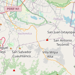


19.3014, -99.0987© OpenStreetMap
Ad slot · 300×250
Places under this code
1| Place | Region | County | Coordinates |
|---|---|---|---|
| San Agustin | Distrito Federal | Milpa Alta | 19.3014, -99.0987 |
Same code in other countries
8| Country | Place | Region |
|---|---|---|
| ES Spain | Castellon De La Plana/Castello De La Pla | Comunidad Valenciana |
| IT Italy | Alto | Piemonte |
| KR South Korea | 진접읍 | 경기도 |
| LK Sri Lanka | Beruwala | Western Province |
| PK Pakistan | Nalian | Azad Jammu and Kashmir |
| SE Sweden | Stockholm | Stockholm |
| UA Ukraine | Буряківка | Zhytomyrska |
| US United States | Fort Johnson | New York |
FAQ
Which city is 12070 in?
San Agustin, Distrito Federal, Mexico.
What are the coordinates of 12070?
19.3014, -99.0987
Is 12070 used in other countries?
Yes, 8 other countries.
Updated 2026-11-09. Attribution in Data & license.