ST14 postal code
United KingdomUpdated 2026-11-09Beamhurst, EnglandStaffordshireOutcode
Postal code details
15 placesCode
ST14
Place
Beamhurst
Region
England
County
Staffordshire
Coordinates
52.9042, -1.8694
Accuracy
3 / 6
Country
United Kingdom
Location
OpenStreetMap ↗
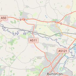


52.9042, -1.8694© OpenStreetMap
Ad slot · 300×250
Places under this code
15| Place | Region | County | Coordinates |
|---|---|---|---|
| Beamhurst | England | Staffordshire | 52.9042, -1.8694 |
| Blount's Green | England | Staffordshire | 52.9042, -1.8694 |
| Bramshall | England | Staffordshire | 52.8952, -1.9105 |
| Croxden | England | Staffordshire | 52.9545, -1.9015 |
| Denstone | England | Staffordshire | 52.9633, -1.8524 |
| Field | England | Staffordshire | 52.9042, -1.8694 |
| Fole | England | Staffordshire | 52.9042, -1.8694 |
| Gratwich | England | Staffordshire | 52.9042, -1.8694 |
| Grindley | England | Staffordshire | 52.86, -1.9468 |
| Kingstone | England | Staffordshire | 52.867, -1.9218 |
| Marchington | England | Staffordshire | 52.8755, -1.8024 |
| Marchington Woodlands | England | Staffordshire | 52.8546, -1.8261 |
| Rocester | England | Staffordshire | 52.9513, -1.8399 |
| Stramshall | England | Staffordshire | 52.9042, -1.8694 |
| Uttoxeter | England | Staffordshire | 52.8984, -1.8649 |
Same code in other countries
0This code only appears in this country.
FAQ
Which city is ST14 in?
Beamhurst, England, United Kingdom.
What are the coordinates of ST14?
52.9042, -1.8694
Is ST14 used in other countries?
No.
Updated 2026-11-09. Attribution in Data & license.