SP5 postal code
United KingdomUpdated 2026-11-09Alderbury, EnglandWiltshireOutcode
Postal code details
50 placesCode
SP5
Place
Alderbury
Region
England
County
Wiltshire
Coordinates
51.0435, -1.7338
Accuracy
4 / 6
Country
United Kingdom
Location
OpenStreetMap ↗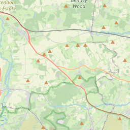
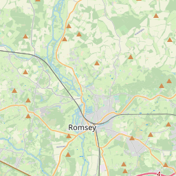
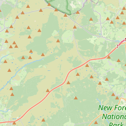
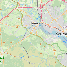
51.0435, -1.7338© OpenStreetMap
Ad slot · 300×250
Places under this code
50| Place | Region | County | Coordinates |
|---|---|---|---|
| Alderbury | England | Wiltshire | 51.0435, -1.7338 |
| Alvediston | England | Wiltshire | 51.0101, -2.0348 |
| Ashmore | England | Dorset | 50.95, -2.1333 |
| Bishopstone | England | Wiltshire | 51.0303, -1.9027 |
| Bodenham | England | Wiltshire | 51.0209, -1.7739 |
| Bowerchalke | England | Wiltshire | 51, -1.9667 |
| Britford | England | Wiltshire | 51.0542, -1.7735 |
| Broad Chalke | England | Wiltshire | 51.0272, -1.9485 |
| Charlton-All-Saints | England | Wiltshire | 51.1024, -1.8434 |
| Coombe Bissett | England | Wiltshire | 51.0363, -1.8458 |
| Dean | England | Wiltshire | 51.1024, -1.8434 |
| Deanland | England | Wiltshire | 51.1024, -1.8434 |
| Downton | England | Wiltshire | 51, -1.7333 |
| East Dean | England | Hampshire | 51.0398, -1.6094 |
| East Grimstead | England | Wiltshire | 51.0505, -1.6785 |
| East Tytherley | England | Hampshire | 51.0609, -1.5804 |
| Ebbesborne Wake | England | Wiltshire | 51.0147, -2.0119 |
| Farley | England | Wiltshire | 51.05, -1.6833 |
| Fifield Bavant | England | Wiltshire | 51.1024, -1.8434 |
| Firs Road | England | Wiltshire | 51.1024, -1.8434 |
| Hamptworth | England | Wiltshire | 51.1024, -1.8434 |
| Homington | England | Wiltshire | 51.1024, -1.8434 |
| Landford | England | Wiltshire | 50.9683, -1.6354 |
| Lopcombe Corner | England | Wiltshire | 51.1024, -1.8434 |
| Lover | England | Wiltshire | 51.1024, -1.8434 |
| Mead End | England | Wiltshire | 51.1024, -1.8434 |
| Middle Winterslow | England | Wiltshire | 51.0935, -1.6545 |
| Morgan's Vale | England | Wiltshire | 51.1024, -1.8434 |
| Newton | England | Wiltshire | 51.0209, -1.7739 |
| Nomansland | England | Wiltshire | 51.1024, -1.8434 |
| North Charford | England | Wiltshire | 51.1024, -1.8434 |
| Nunton | England | Wiltshire | 51.1024, -1.8434 |
| Odstock | England | Wiltshire | 51.0344, -1.7926 |
| Pentridge | England | Dorset | 50.9594, -1.9527 |
| Pitton | England | Wiltshire | 51.0667, -1.7 |
| Plaitford | England | Hampshire | 50.9667, -1.6 |
| Redlynch | England | Wiltshire | 50.9873, -1.7116 |
| Sixpenny Handley | England | Dorset | 50.9541, -2.0104 |
| Stratford Tony | England | Wiltshire | 51.1024, -1.8434 |
| The Common | England | Wiltshire | 51.1024, -1.8434 |
| Tollard Royal | England | Wiltshire | 50.9596, -2.0805 |
| West Dean | England | Wiltshire | 51.0426, -1.6351 |
| West Grimstead | England | Wiltshire | 51.0393, -1.7009 |
| West Tytherley | England | Hampshire | 51.0633, -1.6155 |
| West Winterslow | England | Wiltshire | 51.0898, -1.6705 |
| Whaddon | England | Wiltshire | 51.0209, -1.7739 |
| Whiteparish | England | Wiltshire | 51.0104, -1.6486 |
| Wick | England | Wiltshire | 51.0209, -1.7739 |
| Winterslow | England | Wiltshire | 51.0972, -1.6631 |
| Woodcutts | England | Wiltshire | 51.1024, -1.8434 |
Same code in other countries
0This code only appears in this country.
FAQ
Which city is SP5 in?
Alderbury, England, United Kingdom.
What are the coordinates of SP5?
51.0435, -1.7338
Is SP5 used in other countries?
No.
Updated 2026-11-09. Attribution in Data & license.