RH17 postal code
United KingdomUpdated 2026-11-09Ansty, EnglandWest SussexOutcode
Postal code details
21 placesCode
RH17
Place
Ansty
Region
England
County
West Sussex
Coordinates
50.9933, -0.1567
Accuracy
4 / 6
Country
United Kingdom
Location
OpenStreetMap ↗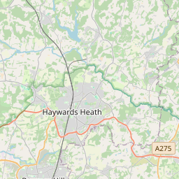
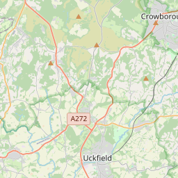

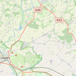
50.9933, -0.1567© OpenStreetMap
Ad slot · 300×250
Places under this code
21| Place | Region | County | Coordinates |
|---|---|---|---|
| Ansty | England | West Sussex | 50.9933, -0.1567 |
| Ardingly | England | West Sussex | 51.0487, -0.0772 |
| Balcombe | England | West Sussex | 51.0573, -0.1345 |
| Bolney | England | West Sussex | 50.9953, -0.203 |
| Brook Street | England | West Sussex | 51.0107, -0.146 |
| Chelwood Gate | England | West Sussex | 51.0107, -0.146 |
| Cuckfield | England | West Sussex | 51.0107, -0.1407 |
| Danehill | England | East Sussex | 51.0407, 0.0109 |
| Handcross | England | West Sussex | 51.0538, -0.2008 |
| Hickstead | England | West Sussex | 50.9682, -0.195 |
| Highbrook | England | West Sussex | 51.0107, -0.146 |
| Horsted Keynes | England | West Sussex | 51.0366, -0.028 |
| Sandrocks | England | West Sussex | 51.0107, -0.146 |
| Scayne's Hill | England | West Sussex | 51.0107, -0.146 |
| Slaugham | England | West Sussex | 51.0386, -0.2077 |
| Staplefield | England | West Sussex | 51.038, -0.1814 |
| Twineham | England | West Sussex | 50.9663, -0.2108 |
| Warninglid | England | West Sussex | 51.0107, -0.146 |
| Whitemans Green | England | West Sussex | 51.0107, -0.146 |
| Wivelsfield | England | East Sussex | 50.9691, -0.0909 |
| Wivelsfield Green | England | East Sussex | 50.9631, -0.0713 |
Same code in other countries
0This code only appears in this country.
FAQ
Which city is RH17 in?
Ansty, England, United Kingdom.
What are the coordinates of RH17?
50.9933, -0.1567
Is RH17 used in other countries?
No.
Updated 2026-11-09. Attribution in Data & license.