LE14 postal code
United KingdomUpdated 2026-11-09Ab Kettleby, EnglandLeicestershireOutcode
Postal code details
48 placesCode
LE14
Place
Ab Kettleby
Region
England
County
Leicestershire
Coordinates
52.8004, -0.9261
Accuracy
4 / 6
Country
United Kingdom
Location
OpenStreetMap ↗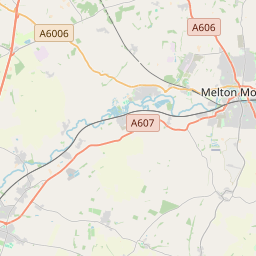
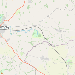
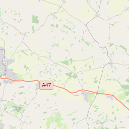
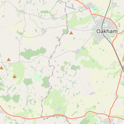
52.8004, -0.9261© OpenStreetMap
Ad slot · 300×250
Places under this code
48| Place | Region | County | Coordinates |
|---|---|---|---|
| Ab Kettleby | England | Leicestershire | 52.8004, -0.9261 |
| Asfordby | England | Leicestershire | 52.7633, -0.9586 |
| Asfordby Hill | England | Leicestershire | 52.8094, -0.8701 |
| Ashby Folville | England | Leicestershire | 52.7008, -0.9554 |
| Brentingby | England | Leicestershire | 52.8094, -0.8701 |
| Brooksby | England | Leicestershire | 52.8094, -0.8701 |
| Burrough on the Hill | England | Leicestershire | 52.8094, -0.8701 |
| Burton Lazars | England | Leicestershire | 52.7441, -0.8642 |
| Chadwell | England | Leicestershire | 52.8, -0.8333 |
| Coston | England | Leicestershire | 52.7916, -0.7448 |
| Eastwell | England | Leicestershire | 52.85, -0.8497 |
| Edmondthorpe | England | Leicestershire | 52.7499, -0.726 |
| Freeby | England | Leicestershire | 52.7726, -0.8108 |
| Frisby on the Wreake | England | Leicestershire | 52.7513, -0.9701 |
| Garthorpe | England | Leicestershire | 52.7802, -0.7567 |
| Goadby Marwood | England | Leicestershire | 52.8297, -0.8408 |
| Great Dalby | England | Leicestershire | 52.7229, -0.9003 |
| Grimston | England | Leicestershire | 52.7901, -0.9866 |
| Harby | England | Leicestershire | 52.873, -0.8957 |
| Hickling | England | Nottinghamshire | 52.8505, -0.983 |
| Hoby | England | Leicestershire | 52.7508, -1.0095 |
| Holwell | England | Leicestershire | 52.7833, -0.9 |
| Hose | England | Leicestershire | 52.857, -0.9043 |
| Kirkby Bellars | England | Leicestershire | 52.8094, -0.8701 |
| Little Dalby | England | Leicestershire | 52.7195, -0.8485 |
| Long Clawson | England | Leicestershire | 52.8373, -0.9288 |
| Nether Broughton | England | Leicestershire | 52.8249, -0.9706 |
| Old Dalby | England | Leicestershire | 52.8071, -1.0031 |
| Pickwell | England | Leicestershire | 52.8094, -0.8701 |
| Ragdale | England | Leicestershire | 52.7715, -1.0199 |
| Rotherby | England | Leicestershire | 52.8094, -0.8701 |
| Saltby | England | Leicestershire | 52.8276, -0.7369 |
| Saxby | England | Leicestershire | 52.7716, -0.7859 |
| Saxelbye | England | Leicestershire | 52.8094, -0.8701 |
| Scalford | England | Leicestershire | 52.8096, -0.8696 |
| Somerby | England | Leicestershire | 52.6874, -0.8501 |
| Sproxton | England | Leicestershire | 52.8104, -0.7349 |
| Stapleford | England | Leicestershire | 52.7554, -0.7994 |
| Stathern | England | Leicestershire | 52.872, -0.8552 |
| Stonesby | England | Leicestershire | 52.8134, -0.7802 |
| Thorpe Arnold | England | Leicestershire | 52.8094, -0.8701 |
| Thorpe Satchville | England | Leicestershire | 52.6982, -0.9166 |
| Twyford | England | Leicestershire | 52.6844, -0.9237 |
| Upper Broughton | England | Nottinghamshire | 52.8286, -0.9877 |
| Waltham on the Wolds | England | Leicestershire | 52.817, -0.8084 |
| Wartnaby | England | Leicestershire | 52.8022, -0.9449 |
| Wycomb | England | Leicestershire | 52.8094, -0.8701 |
| Wymondham | England | Leicestershire | 52.7598, -0.7405 |
Same code in other countries
0This code only appears in this country.
FAQ
Which city is LE14 in?
Ab Kettleby, England, United Kingdom.
What are the coordinates of LE14?
52.8004, -0.9261
Is LE14 used in other countries?
No.
Updated 2026-11-09. Attribution in Data & license.