DY9 postal code
United KingdomUpdated 2026-11-09Belbroughton, EnglandWorcestershireOutcode
Postal code details
10 placesCode
DY9
Place
Belbroughton
Region
England
County
Worcestershire
Coordinates
52.3918, -2.1188
Accuracy
4 / 6
Country
United Kingdom
Location
OpenStreetMap ↗
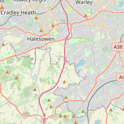


52.3918, -2.1188© OpenStreetMap
Ad slot · 300×250
Places under this code
10| Place | Region | County | Coordinates |
|---|---|---|---|
| Belbroughton | England | Worcestershire | 52.3918, -2.1188 |
| Bell End | England | Worcestershire | 52.3739, -2.123 |
| Broome | England | Worcestershire | 52.4012, -2.1499 |
| Clent | England | Worcestershire | 52.4132, -2.1054 |
| Drayton | England | West Midlands | 52.4345, -2.1226 |
| Hagley | England | Worcestershire | 52.4262, -2.1282 |
| Holy Cross | England | Worcestershire | 52.3739, -2.123 |
| Lye | England | West Midlands | 52.4584, -2.117 |
| Pedmore | England | West Midlands | 52.4385, -2.1329 |
| West Hagley | England | Worcestershire | 52.3739, -2.123 |
Same code in other countries
0This code only appears in this country.
FAQ
Which city is DY9 in?
Belbroughton, England, United Kingdom.
What are the coordinates of DY9?
52.3918, -2.1188
Is DY9 used in other countries?
No.
Updated 2026-11-09. Attribution in Data & license.