DN14 postal code
United KingdomUpdated 2026-11-09Adlingfleet, EnglandEast Riding of YorkshireOutcode
Postal code details
40 placesCode
DN14
Place
Adlingfleet
Region
England
County
East Riding of Yorkshire
Coordinates
53.6788, -0.7231
Accuracy
4 / 6
Country
United Kingdom
Location
OpenStreetMap ↗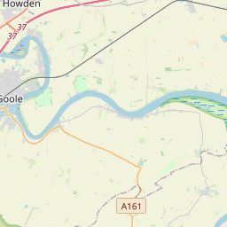


53.6788, -0.7231© OpenStreetMap
Ad slot · 300×250
Places under this code
40| Place | Region | County | Coordinates |
|---|---|---|---|
| Adlingfleet | England | East Riding of Yorkshire | 53.6788, -0.7231 |
| Airmyn | England | East Riding of Yorkshire | 53.7207, -0.8996 |
| Asselby | England | East Riding of Yorkshire | 53.7427, -0.8849 |
| Balkholme | England | East Riding of Yorkshire | 53.7432, -0.8087 |
| Barmby on the Marsh | England | East Riding of Yorkshire | 53.749, -0.9561 |
| Beal | England | North Yorkshire | 53.7193, -1.1932 |
| Bellasize | England | East Riding of Yorkshire | 53.7125, -0.8909 |
| Blacktoft | England | East Riding of Yorkshire | 53.708, -0.7273 |
| Carlton | England | North Yorkshire | 53.7065, -1.0229 |
| East Cowick | England | East Riding of Yorkshire | 53.7125, -0.8909 |
| Eastrington | England | East Riding of Yorkshire | 53.7604, -0.7932 |
| Faxfleet | England | East Riding of Yorkshire | 53.7067, -0.6939 |
| Goole | England | East Riding of Yorkshire | 53.7167, -0.8667 |
| Gowdall | England | East Riding of Yorkshire | 53.693, -1.0597 |
| Great Heck | England | North Yorkshire | 53.6822, -1.1043 |
| Gribthorpe | England | East Riding of Yorkshire | 53.7125, -0.8909 |
| Hensall | England | North Yorkshire | 53.7025, -1.1072 |
| Hook | England | East Riding of Yorkshire | 53.7205, -0.8479 |
| Howden | England | East Riding of Yorkshire | 53.7421, -0.8657 |
| Kellington | England | North Yorkshire | 53.7184, -1.1656 |
| Kilpin | England | East Riding of Yorkshire | 53.7316, -0.8312 |
| Knedlington | England | East Riding of Yorkshire | 53.7427, -0.8849 |
| Laxton | England | East Riding of Yorkshire | 53.7167, -0.8 |
| Low Eggborough | England | East Riding of Yorkshire | 53.7125, -0.8909 |
| Newsholme | England | East Riding of Yorkshire | 53.7125, -0.8909 |
| Old Goole | England | East Riding of Yorkshire | 53.7125, -0.8909 |
| Ousefleet | England | East Riding of Yorkshire | 53.6982, -0.7409 |
| Pollington | England | East Riding of Yorkshire | 53.6709, -1.0724 |
| Rawcliffe | England | East Riding of Yorkshire | 53.6833, -0.95 |
| Rawcliffe Bridge | England | East Riding of Yorkshire | 53.7125, -0.8909 |
| Reedness | England | East Riding of Yorkshire | 53.6993, -0.7986 |
| Saltmarshe | England | East Riding of Yorkshire | 53.7216, -0.8049 |
| Skelton | England | East Riding of Yorkshire | 53.7167, -0.8333 |
| Snaith | England | East Riding of Yorkshire | 53.6911, -1.0286 |
| Spaldington | England | East Riding of Yorkshire | 53.7927, -0.849 |
| Swinefleet | England | East Riding of Yorkshire | 53.6921, -0.8333 |
| Sykehouse | England | South Yorkshire | 53.6448, -1.0494 |
| Whitgift | England | East Riding of Yorkshire | 53.6953, -0.7671 |
| Whitley | England | North Yorkshire | 53.6833, -1.15 |
| Yokefleet | England | East Riding of Yorkshire | 53.708, -0.7574 |
Same code in other countries
0This code only appears in this country.
FAQ
Which city is DN14 in?
Adlingfleet, England, United Kingdom.
What are the coordinates of DN14?
53.6788, -0.7231
Is DN14 used in other countries?
No.
Updated 2026-11-09. Attribution in Data & license.