DE6 postal code
United KingdomUpdated 2026-11-09Alkmonton, EnglandDerbyshireOutcode
Postal code details
50 placesCode
DE6
Place
Alkmonton
Region
England
County
Derbyshire
Coordinates
52.9342, -1.7136
Accuracy
3 / 6
Country
United Kingdom
Location
OpenStreetMap ↗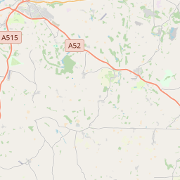

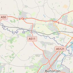
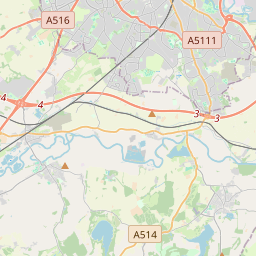
52.9342, -1.7136© OpenStreetMap
Ad slot · 300×250
Places under this code
50| Place | Region | County | Coordinates |
|---|---|---|---|
| Alkmonton | England | Derbyshire | 52.9342, -1.7136 |
| Alsop en le Dale | England | Derbyshire | 53.0934, -1.762 |
| Alstonefield | England | Staffordshire | 53.0983, -1.8066 |
| Ashbourne | England | Derbyshire | 53.0167, -1.7333 |
| Atlow | England | Derbyshire | 53.0326, -1.6567 |
| Ballidon | England | Derbyshire | 53.0887, -1.6976 |
| Biggin | England | Derbyshire | 53.0269, -1.61 |
| Blore | England | Staffordshire | 53.0333, -1.8167 |
| Boylestone | England | Derbyshire | 52.9199, -1.7332 |
| Bradbourne | England | Derbyshire | 53.0708, -1.6924 |
| Bradley | England | Derbyshire | 53.0105, -1.666 |
| Brailsford | England | Derbyshire | 52.9699, -1.6222 |
| Clifton | England | Derbyshire | 53, -1.75 |
| Coton in the Clay | England | Derbyshire | 52.9837, -1.736 |
| Doveridge | England | Derbyshire | 52.9053, -1.8248 |
| Draycott in the Clay | England | Staffordshire | 52.8571, -1.7745 |
| Edlaston | England | Derbyshire | 52.9837, -1.736 |
| Ednaston | England | Derbyshire | 52.9837, -1.736 |
| Ellastone | England | Staffordshire | 52.9851, -1.8266 |
| Fenny Bentley | England | Derbyshire | 53.0504, -1.7384 |
| Great Cubley | England | Derbyshire | 52.9403, -1.7579 |
| Hanging Bridge | England | Derbyshire | 52.9837, -1.736 |
| Hognaston | England | Derbyshire | 53.0513, -1.6501 |
| Hollington | England | Derbyshire | 52.9536, -1.6598 |
| Hulland | England | Derbyshire | 53.0179, -1.6328 |
| Ilam | England | Staffordshire | 53.0548, -1.7996 |
| Kirk Ireton | England | Derbyshire | 53.0479, -1.6031 |
| Kirk Langley | England | Derbyshire | 52.946, -1.5725 |
| Kniveton | England | Derbyshire | 53.0495, -1.6902 |
| Langley Green | England | Derbyshire | 52.9939, -1.718 |
| Lees | England | Derbyshire | 52.9939, -1.718 |
| Longford | England | Derbyshire | 52.9344, -1.6758 |
| Longlane | England | Derbyshire | 52.9837, -1.736 |
| Mapleton | England | Derbyshire | 53.0262, -1.755 |
| Marston Montgomery | England | Derbyshire | 52.9382, -1.8011 |
| Mayfield | England | Staffordshire | 53, -1.7667 |
| Mercaston | England | Derbyshire | 52.9697, -1.5917 |
| Mugginton | England | Derbyshire | 52.9832, -1.5786 |
| Norbury | England | Derbyshire | 52.9667, -1.8167 |
| Osmaston | England | Derbyshire | 52.9926, -1.7045 |
| Parwich | England | Derbyshire | 53.0855, -1.7204 |
| Radbourne | England | Derbyshire | 52.9225, -1.5775 |
| Rodsley | England | Derbyshire | 52.9617, -1.7015 |
| Roston | England | Derbyshire | 52.9837, -1.736 |
| Scropton | England | Derbyshire | 52.869, -1.7148 |
| Shirley | England | Derbyshire | 52.9701, -1.6755 |
| Snelston | England | Derbyshire | 52.9879, -1.7753 |
| Somersal Herbert | England | Derbyshire | 52.914, -1.7966 |
| Stanton | England | Staffordshire | 53.015, -1.8179 |
| Sudbury | England | Staffordshire | 52.8667, -1.75 |
Same code in other countries
0This code only appears in this country.
FAQ
Which city is DE6 in?
Alkmonton, England, United Kingdom.
What are the coordinates of DE6?
52.9342, -1.7136
Is DE6 used in other countries?
No.
Updated 2026-11-09. Attribution in Data & license.